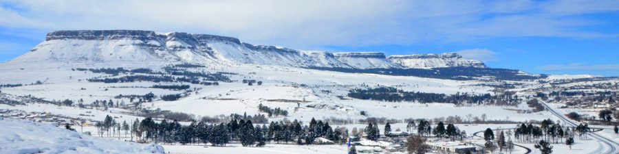
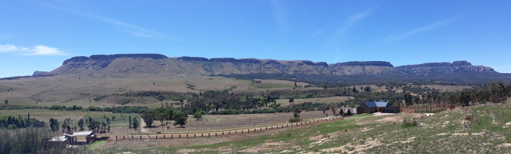
Platberg, overlooking the town of Harrismith in the Free State, is an inselberg that presents a refuge for indigenous plants and animals. And its status is precarious.
– Platberg behind Bakerskop in the foreground –
‘Little is known about the different taxa of Platberg and hence a detailed floristic and ecological survey was undertaken in 2009 by UNISA’s Robert F. Brand, Leslie R. Brown and Pieter J. du Preez to quantify threats to the native flora and to establish whether links exist with higher-altitude Afro-alpine flora occurring on the Drakensberg. Vegetation surveys provide information on the different plant communities and plant species present and form the basis of any management plan for a specific area. No extensive vegetation surveys had been undertaken on Platberg prior to this study; Only limited opportunistic floristic collections were done: Firstly, in the mid-1960s by Mrs. Jacobs. These vouchers were mounted and authenticated in 2006 and are now housed at the Geo Potts Herbarium, Botany Department, University of the Free State;
Secondly, 50 relevés were sampled between 1975 and 1976 by Professor H.J.T. Venter, Department of Genetics and Plant Sciences, University of the Free State.
Mucina & Rutherford 2006 say: ‘Platberg is the single largest and best preserved high-altitude grassland in the Free State. ‘
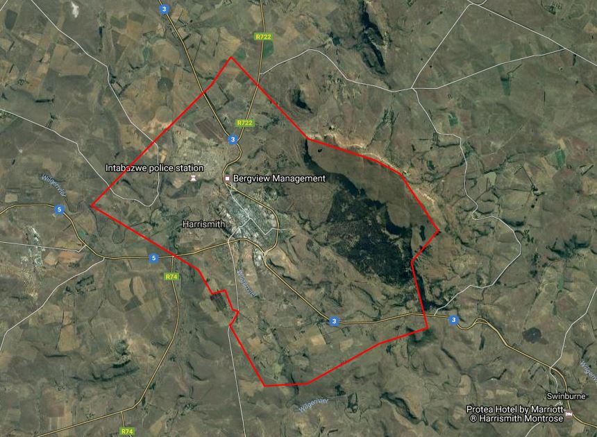
– and I say in 2019: Look how tiny it is! You can hardly see Platberg on this map of all nearby high altitude places. Yet this is our single largest tiny piece of this grassland left!
The authors plead: ‘As an important high-altitude grassland, it is imperative that Platberg be provided with protection legislated on at least a provincial level.’ At present, Platberg is still municipal, with very little protection! – In fact, I think they hire out the grazing for cattle – I hope not, as that really damages the veld and wetlands.
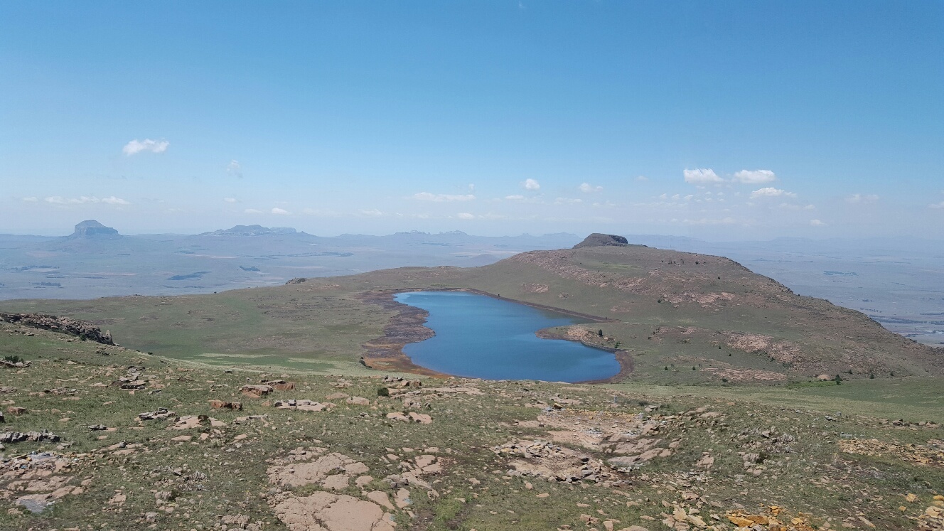
– That tiny island above the ‘th’ in Harrismith = Platberg – – Harrismith townlands –
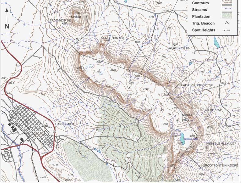
Platberg’s altitude ranges from 1 900m to 2 394m ASL. The surface area covers approximately 3 000ha. The slopes are steep with numerous vegetated gullies and boulder scree slopes below vertical cliffs that are 20m to 45m high. Waterfalls cascade down the southern cliffs after rain. A permanent stream arising from the vleis around, and the vleis drowned by, Gibson Dam on the undulating plateau flows off the escarpment and cascades as a waterfall. From a distance, Platberg appears to have a distinct flat top. However, once on the summit the plateau is found to be undulating, with rolling grass-covered slopes. The vegetation of the plateau is dominated by grassland, with a few rocky ridges, sheet rock and rubble patches, as well as numerous seasonal wetlands and a permanent open playa (pan) – I’ve always called it a tarn – on its far western side. Woody patches of the genera Leucosidea, Buddleja, Kiggelaria, Polygala, Heteromorpha and Rhus shrubs, as well as the indigenous Mountain bamboo Thamnocalamus tessellatus, grow along the base of the cliffs. The shrubland vegetation is concentrated on the cool (town) side of Platberg, on sandstone of the Clarens Formation, in gullies, on scree slopes, mobile boulder beds, and on rocky ridges. Shrubs and trees also occur in a riparian habitat in the south-facing cleft, in which the only road ascends steeply to the summit up Flat Rock Pass. Platberg falls within the Grassland Biome, generally containing short to tall sour grasses. Platberg is a prominent isolated vegetation ‘island’ with affinities to the Drakensberg Grassland Bioregion, embedded in a lower lying matrix of Eastern Free State Sandy Grassland. Platberg also has elements of Fynbos, False Karoo and Succulent Karoo, as well as elements of Temperate and Transitional Forest, specifically Highland Sourveld veld types.
– spot Platberg’s highest point, Ntabazwe 2394m ASL –Looking from highpoint Mtabazwe towards Boobejaanskop eastern tip
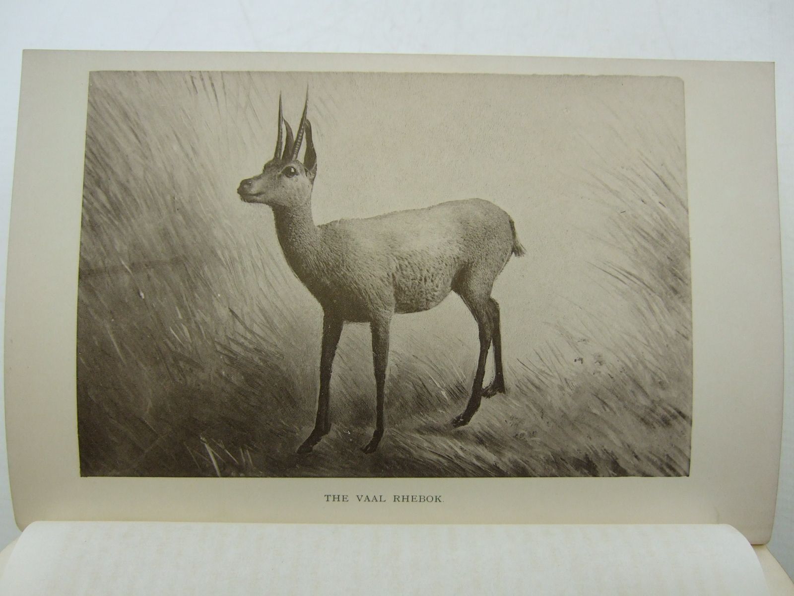
I wonder if there are any grey rhebok left?
Platberg specials– the road up Flat Rock (or Donkey) Pass –
See more of Platberg’s beauty in this amazing post. Damn! Sandra seems to have ended her beautiful blog! Pity!
~~~ooo0oo~~~
inselberg – German for ‘island mountain,’ the word first appeared in English in 1913, apparently because German explorers thought isolated mountains rising from the plains of southern Africa looked like islands in the midst of the ocean. Geologically speaking, an inselberg is a hill of hard volcanic rock that has resisted wind and weather and remained strong and tall as the land around it eroded away. Wikipedia says in South Africa it could also be called a koppie but I think we’d klap anyone who called our Platberg mountain or inselberg a ‘koppie.’
koppie – a smaller thing than Platberg; Just west of Platberg is Loskop; you can call that a koppie, maybe, if you call it a beautiful high koppie with an impressive cliff
relevé – in population ecology, a plot that encloses the minimal area under a species-area curve; right
tarn – tarn is a term derived from tjörn an Old Norse word meaning ‘pond.’ The term’s more specific use as a mountain lake comes from the upland regions of Northern England where tarn is the name given to all ponds. The term retains a broader use since it may refer to any pond or small lake regardless of where it is located or its origin. In the Scandinavian languages the terms tjørn, tärn, tjern, or tjärn are used to refer to small natural lakes that are found closely surrounded with vegetation. Other definitions say a tarn is a post-glacial pond, and Platberg’s is not that, I don’t think. I think it’s fine to keep calling ours the tarn on the western end of Platberg.
~~~oo0oo~~~
Aside: Talking of special high altitude grasslands, who knew of the Korannaberg near the mighty metropolis of Excelsior of dominees-wat-meidenaai fame? It has 767 plant species in its 130km2! It sure looks like a must-visit place! 227 bird species too.
dominees-wat-meidenaai – practicing what you preach against; the old Do as I Say, not as I Do BS that patriarchs try to enforce