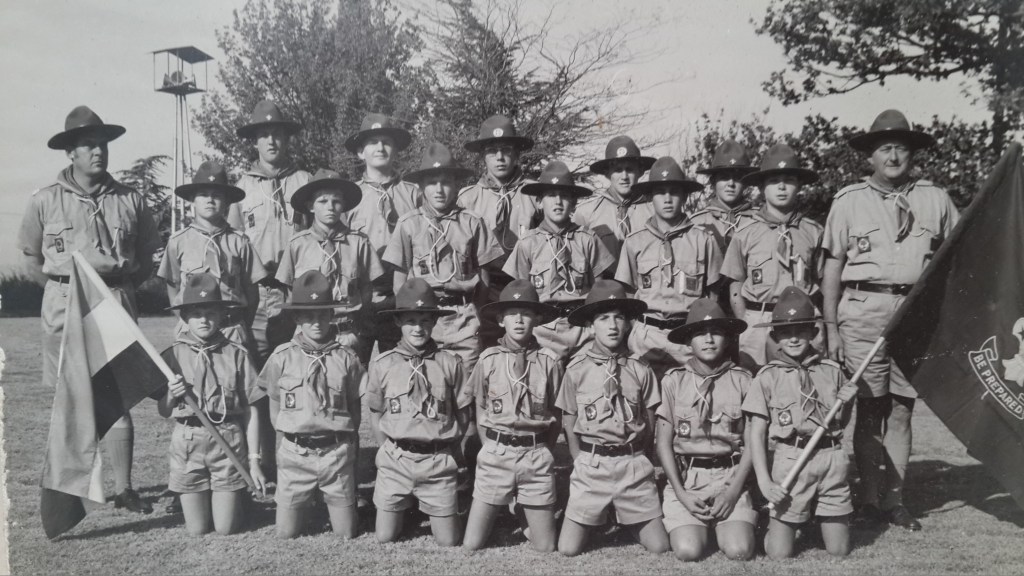
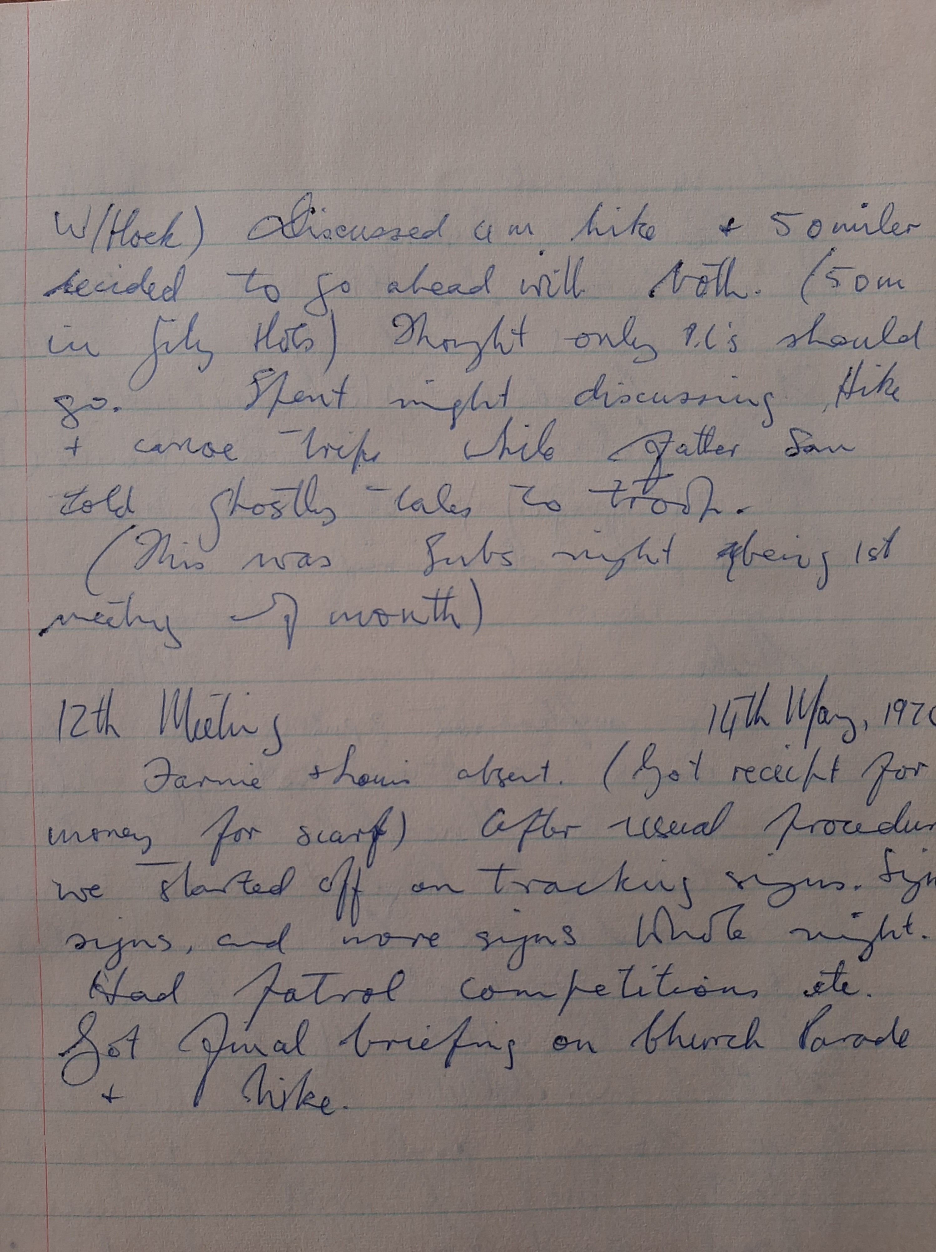
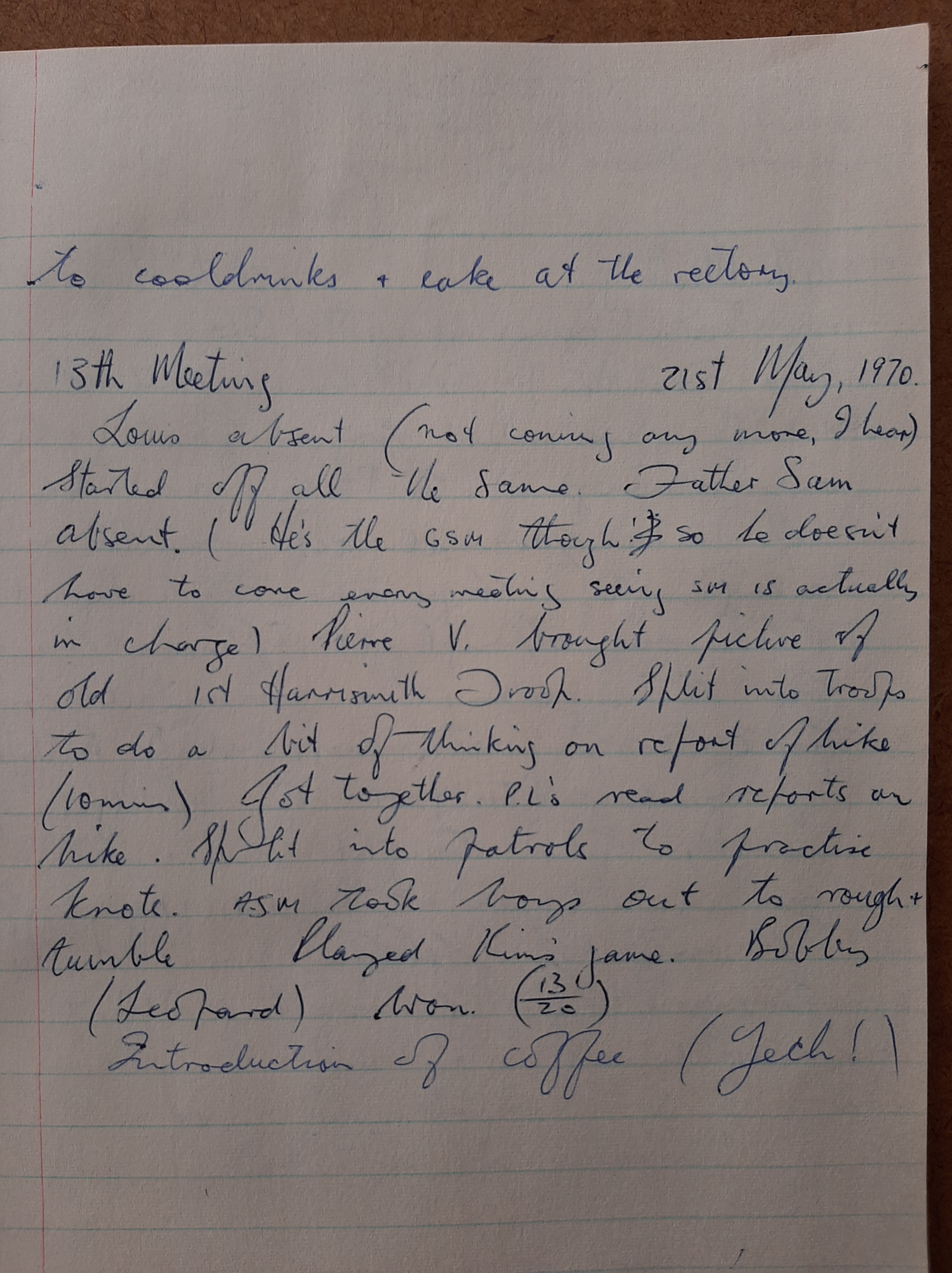
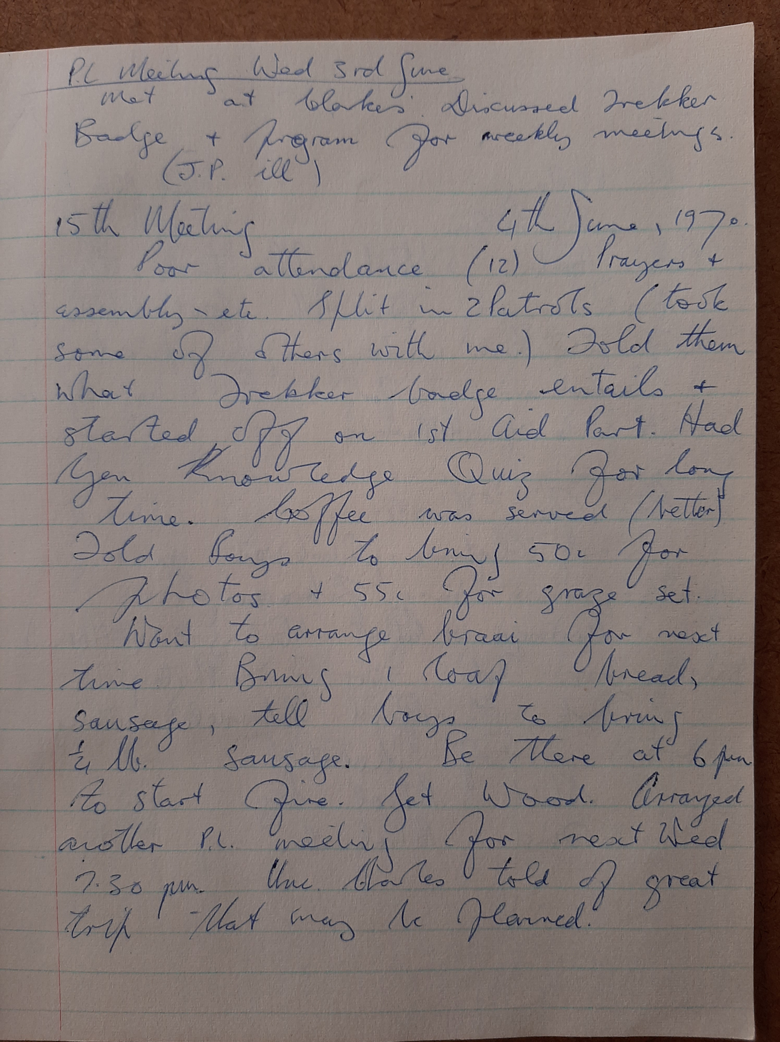
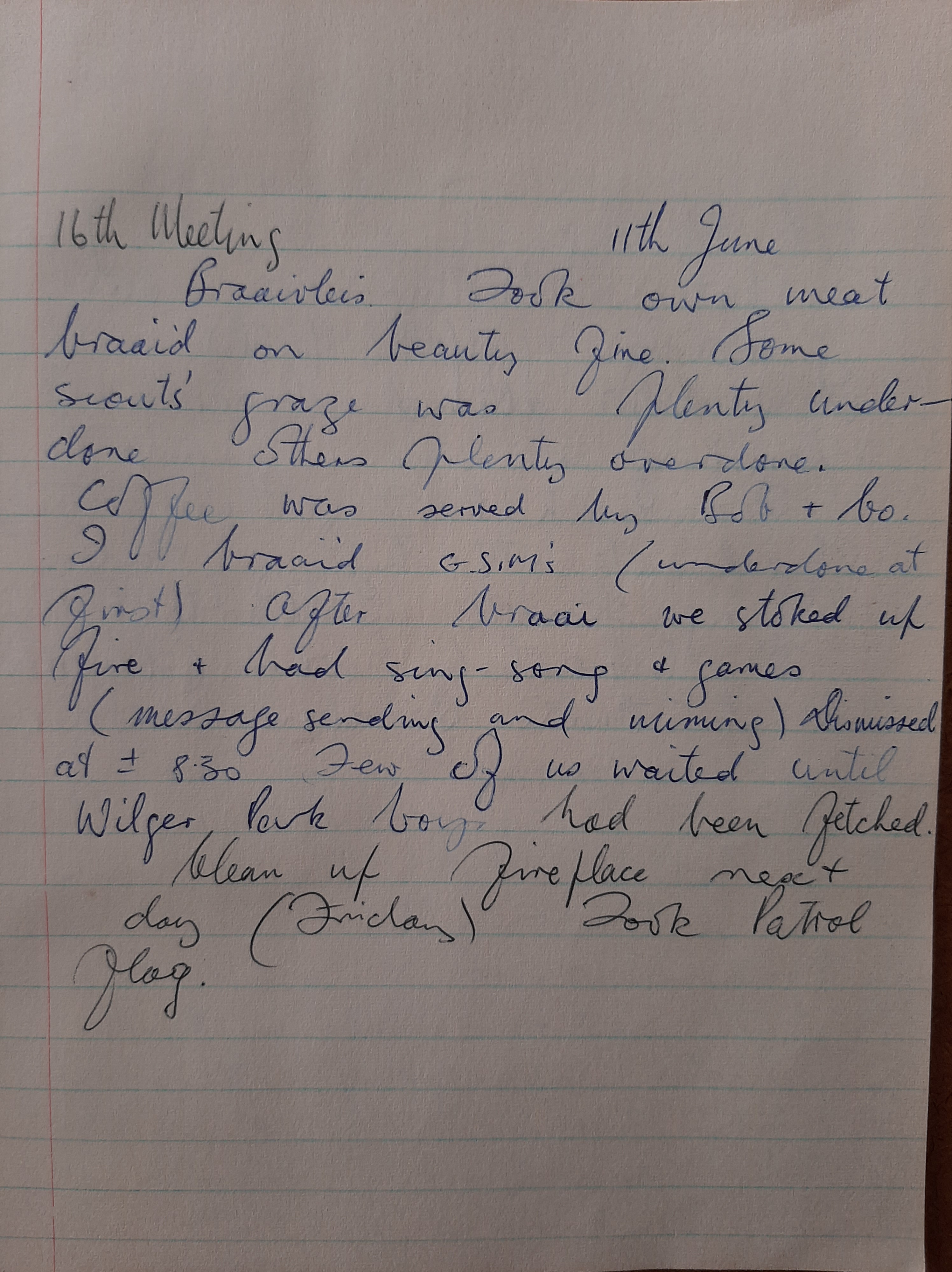
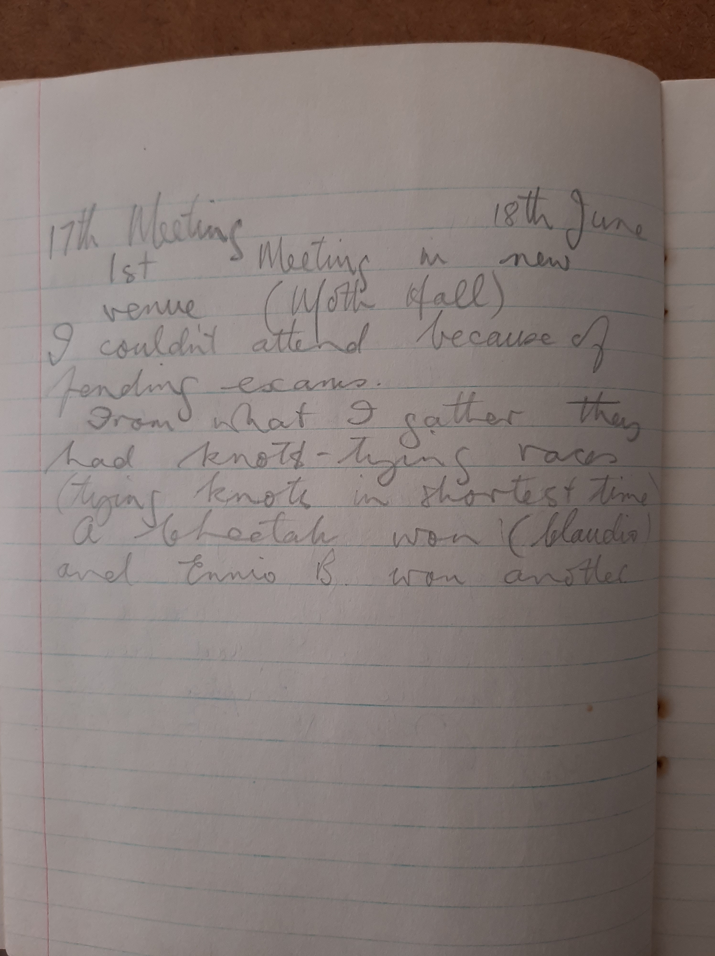
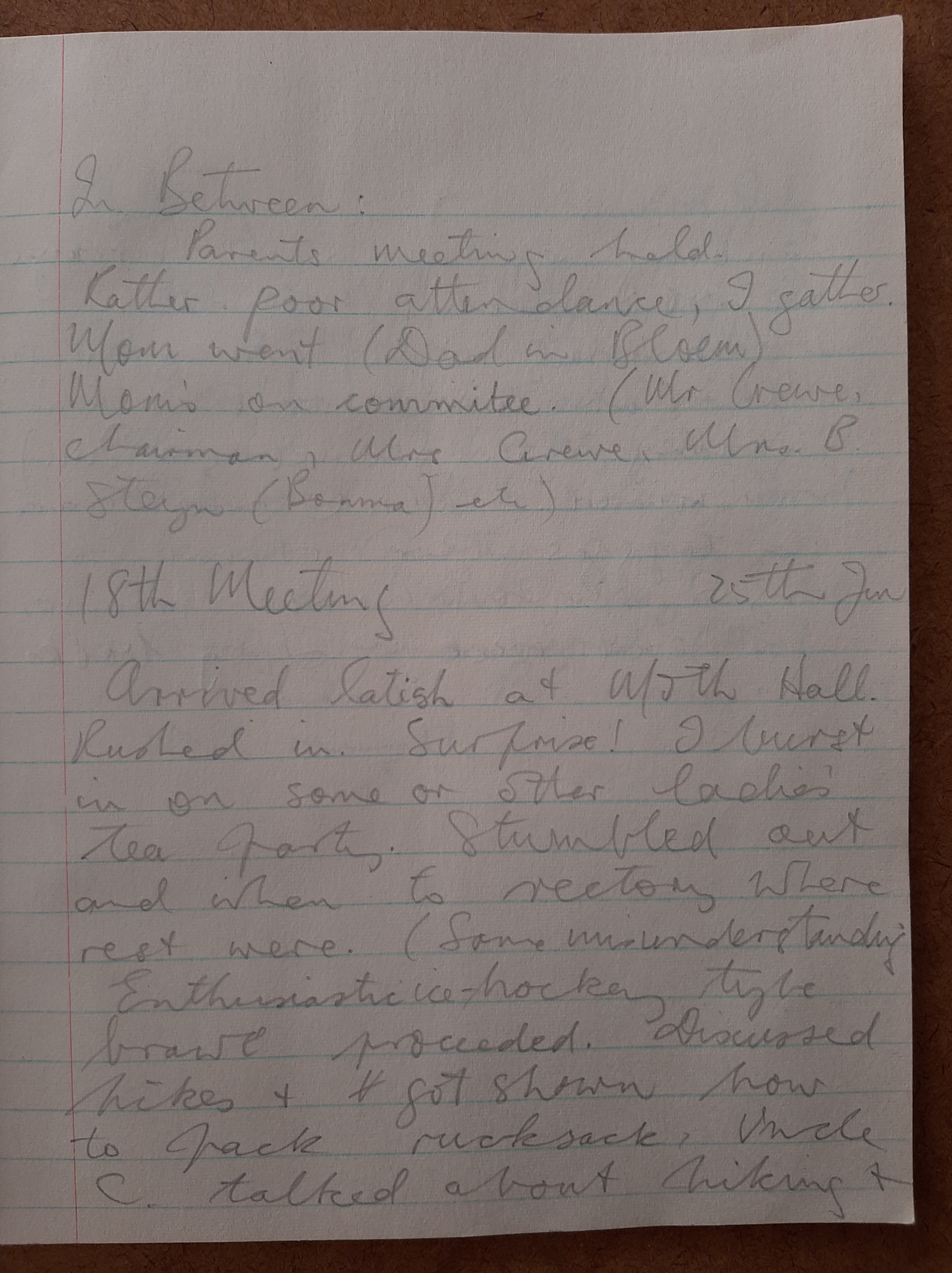
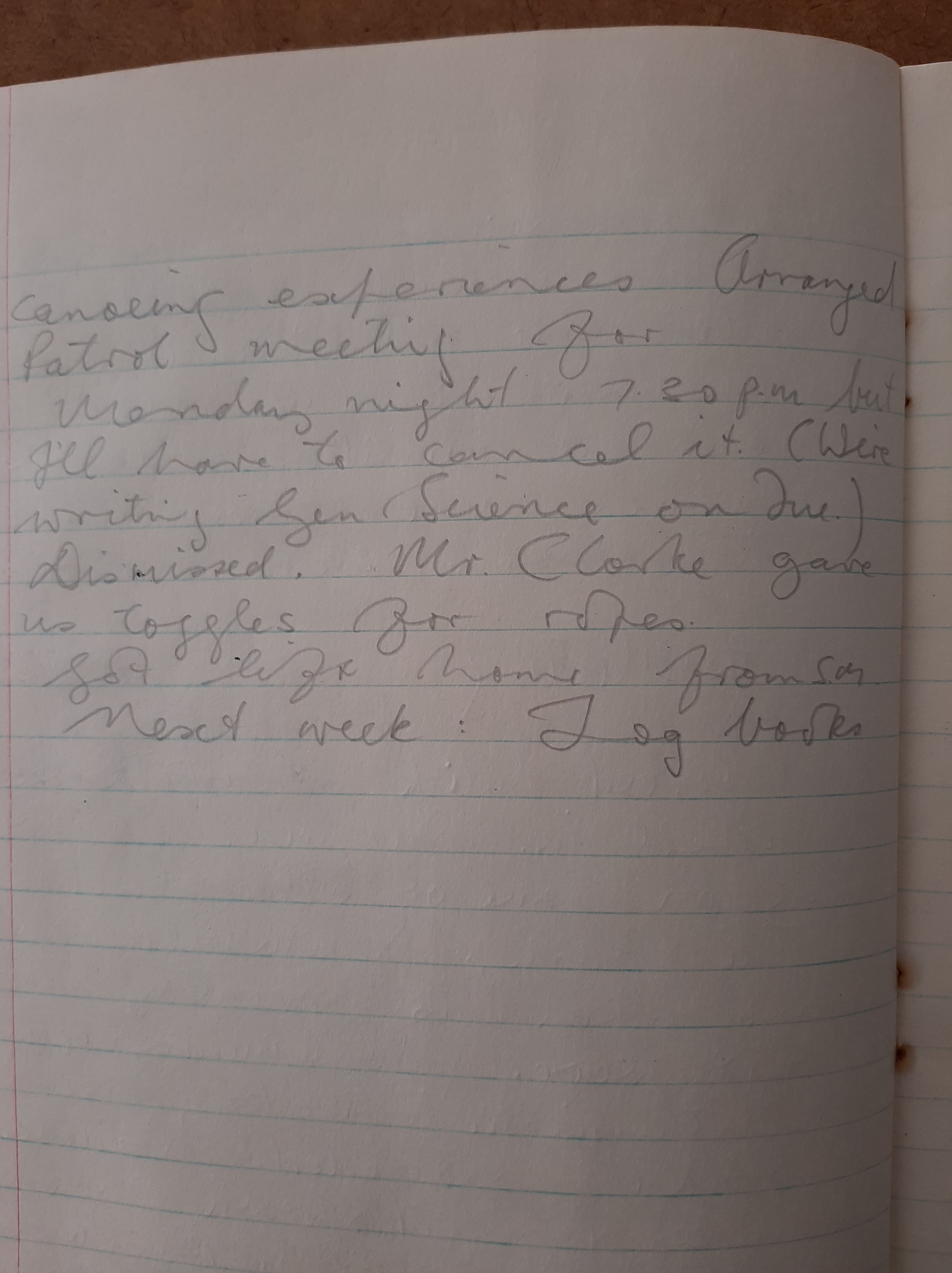
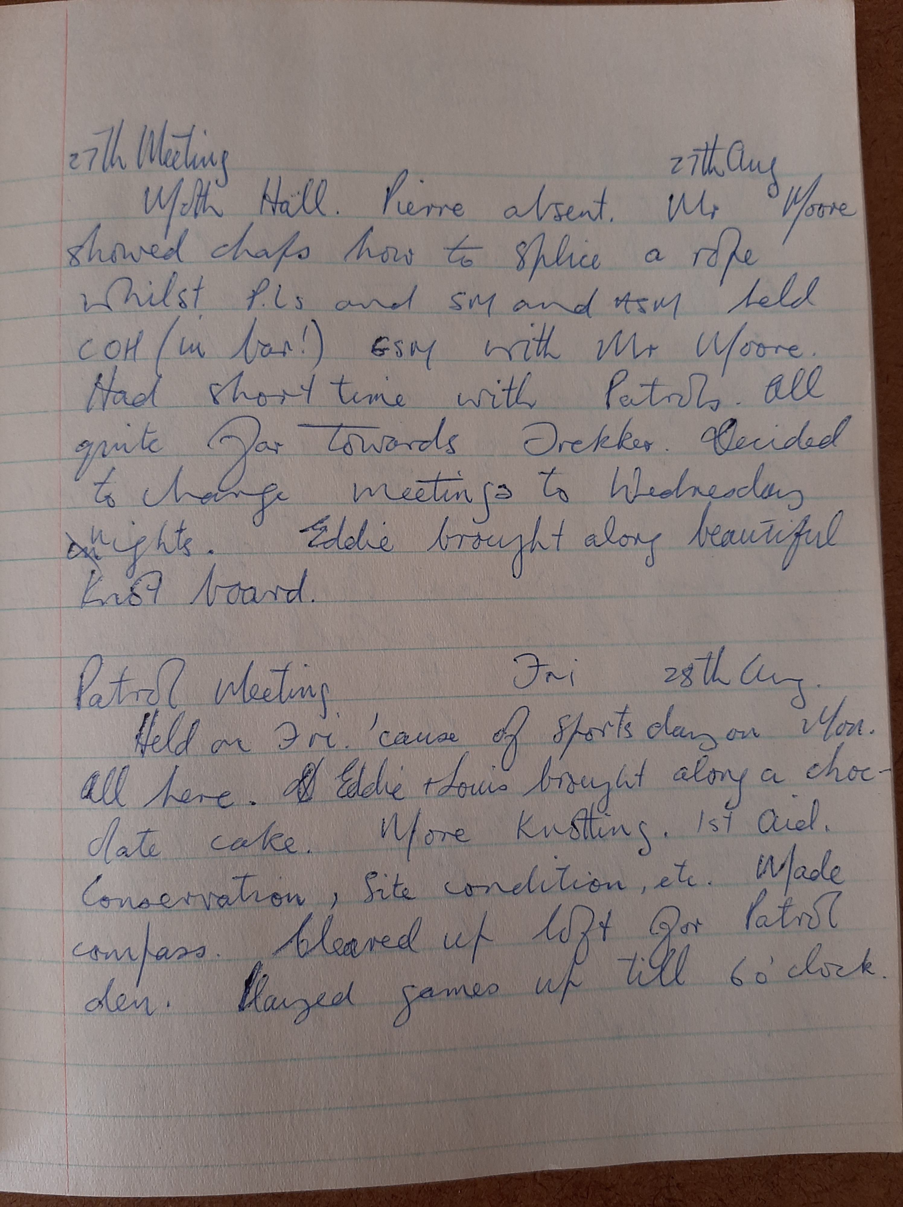
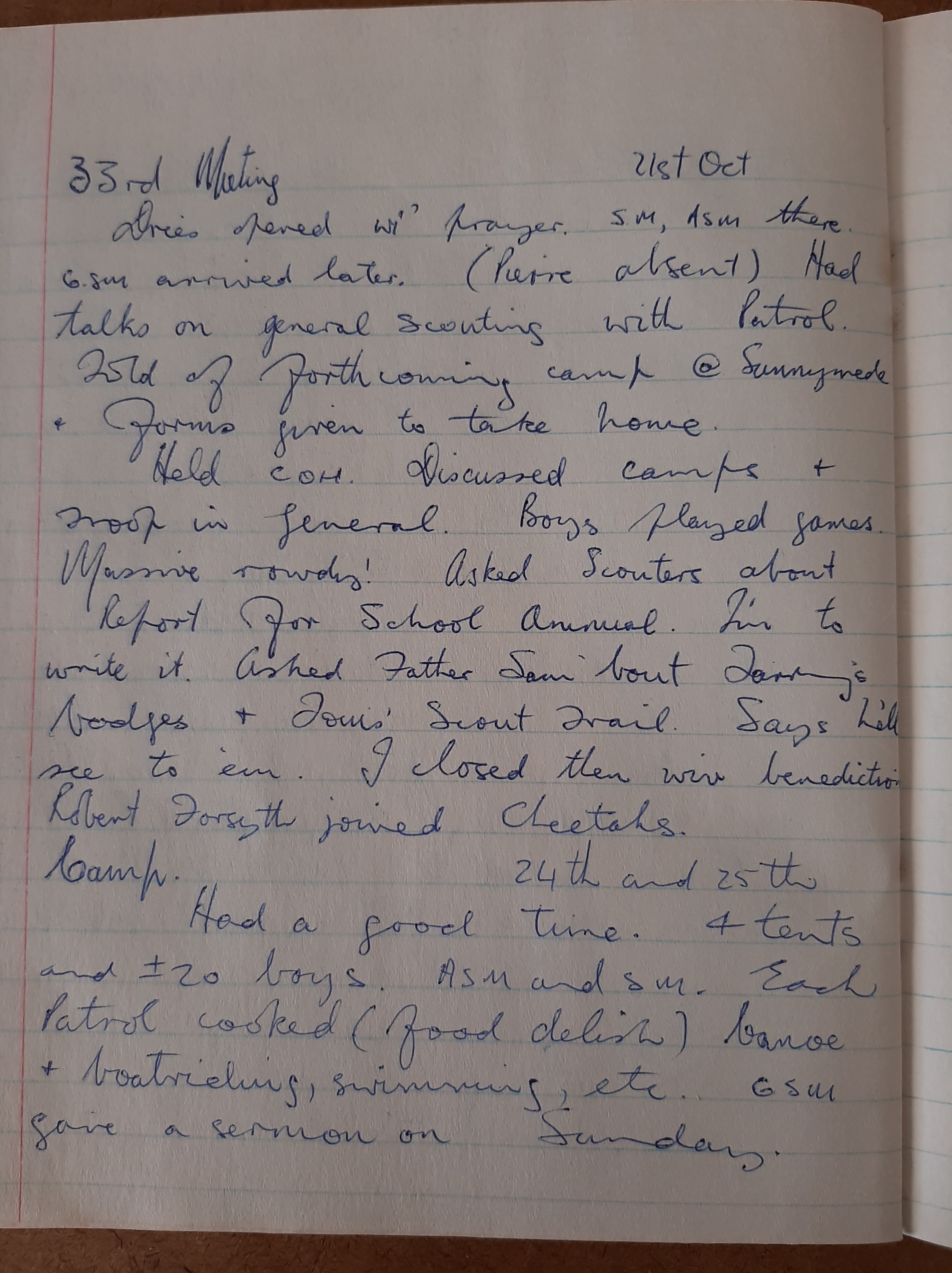
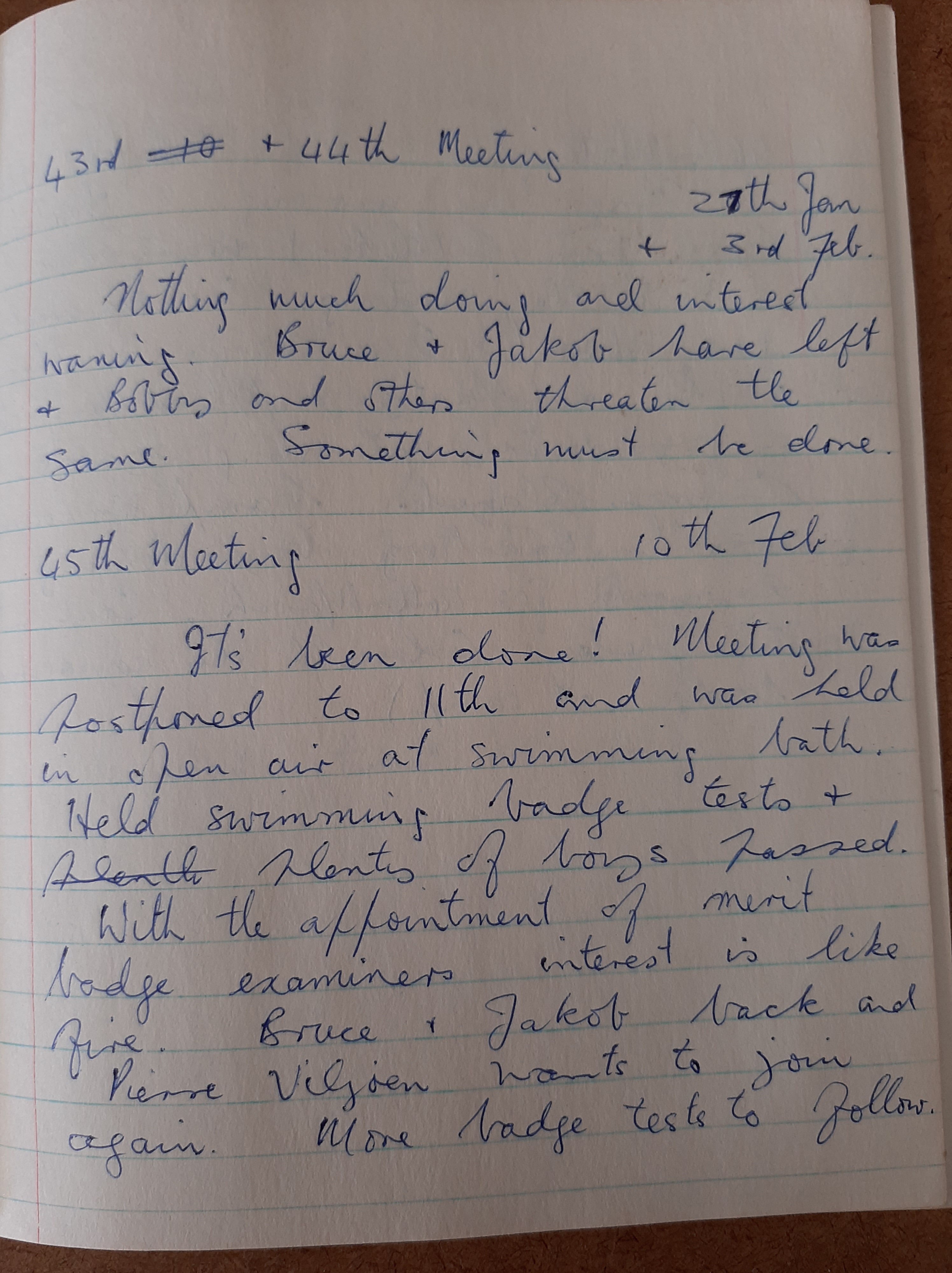
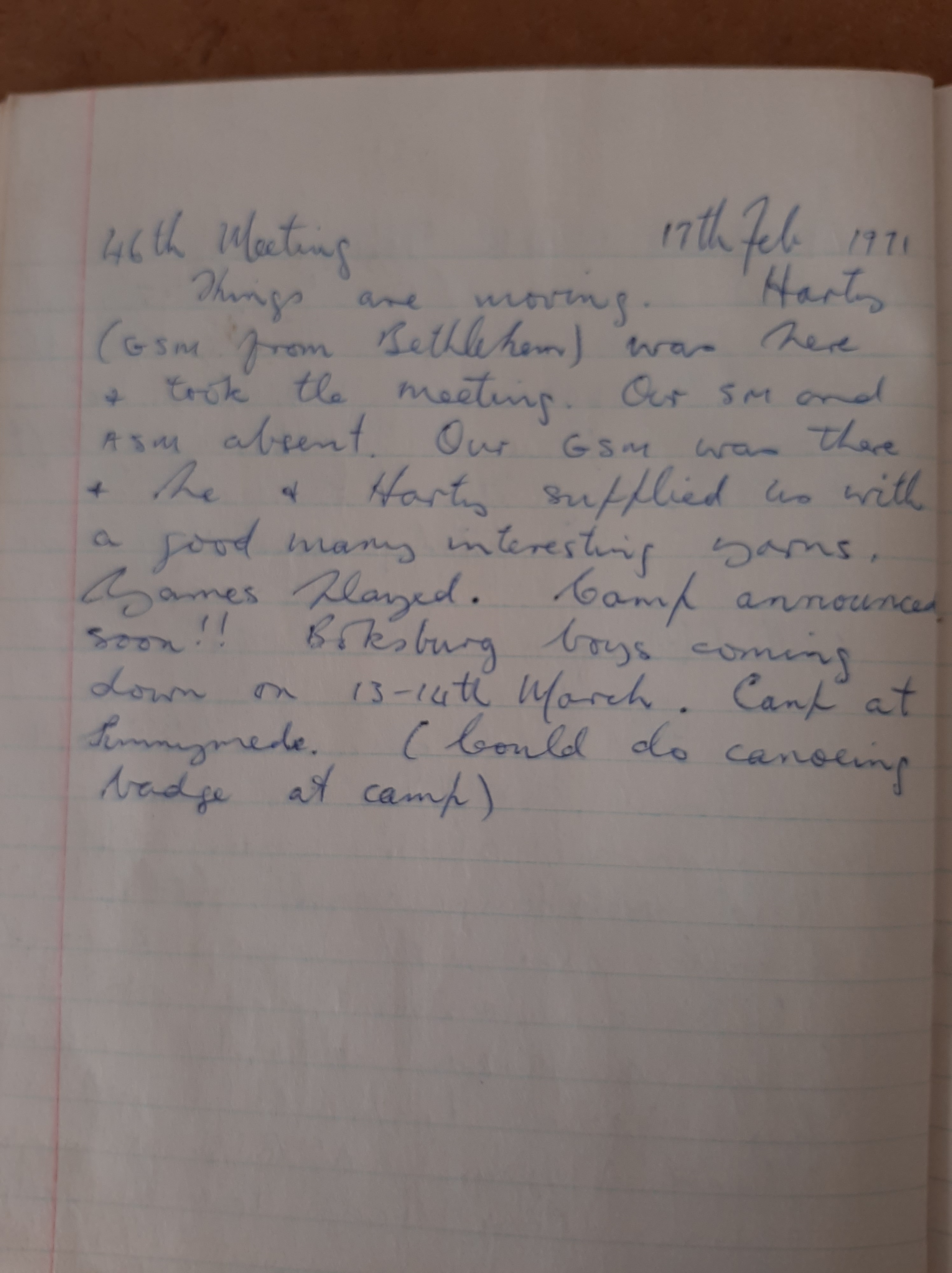
I have written about our lonely little, short-lived Boy Scout troop in the vrystaat and how wonderful it was, how much we learned and how much fun we had, but as I find more and more material in my Big Garage Cleanup, here’s the thing that strikes me most: How incredibly dedicated our troop leaders were and how selflessly they gave of their time and resources. Take this one incident, a memorable hike to test our map-reading and navigating skills:
Father Sam van Muschenbroek was the Scout leader (what’s that called?) and we met at his house at 6:30 on a Friday evening, got into his car and he drove us off. He stopped for petrol and while his car was being filled he blindfolded us – me and Greg Seibert, Rotary exchange student and American Boy Scout, as we were not to know where our hike started, nor did we know the end-point yet. All of that we were to work out from maps and compass readings.
Greg wrote: ‘We were hopelessly lost after a few tricky turns by Father Sam. After a bit of rough and out-of-the-way driving, we arrived’ at our campsite at 7:50pm. We cooked for Father Sam, his son Sam and ourselves and finished eating (spaghetti followed by a can of pears) at 9:35pm, wherupon the Sams drove off without lights (‘tricky, tricky’ wrote Greg).
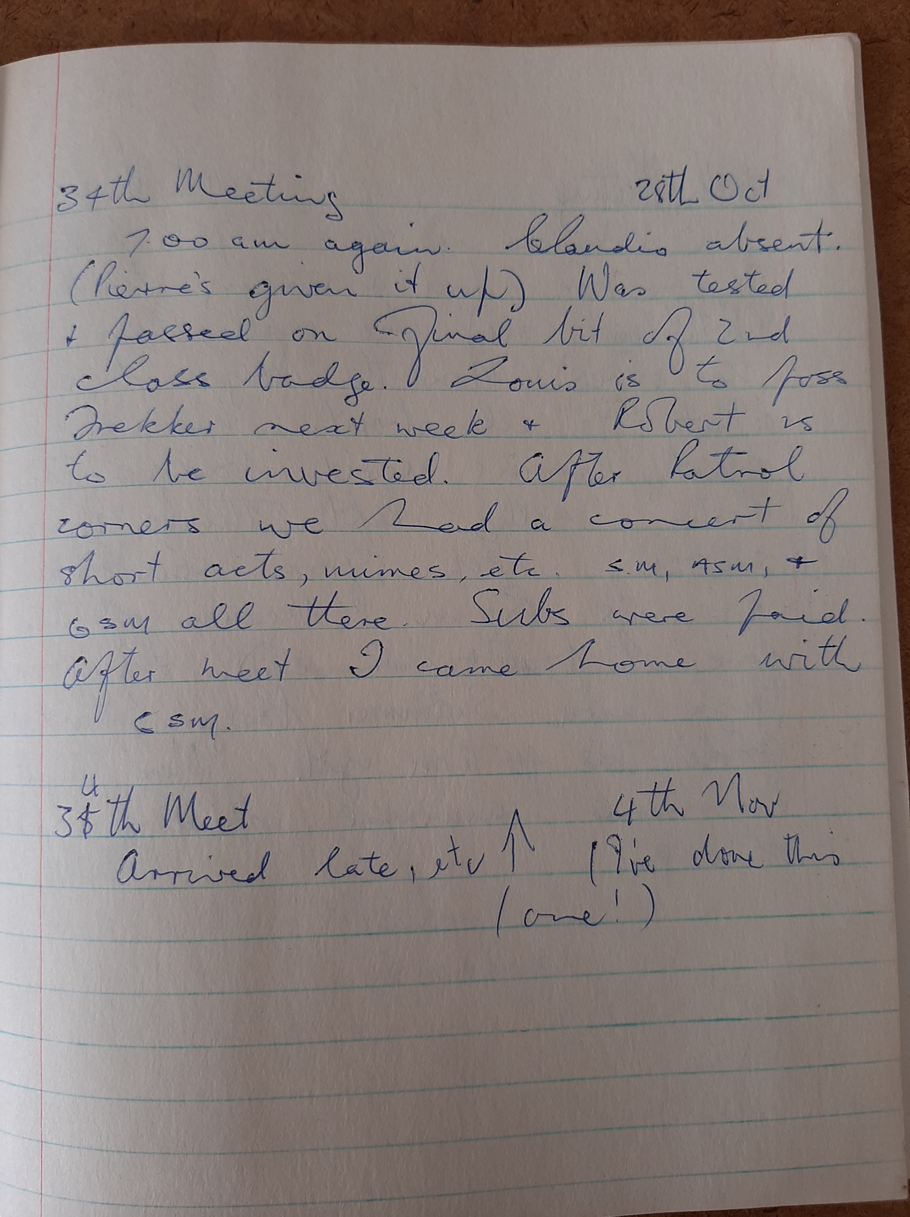
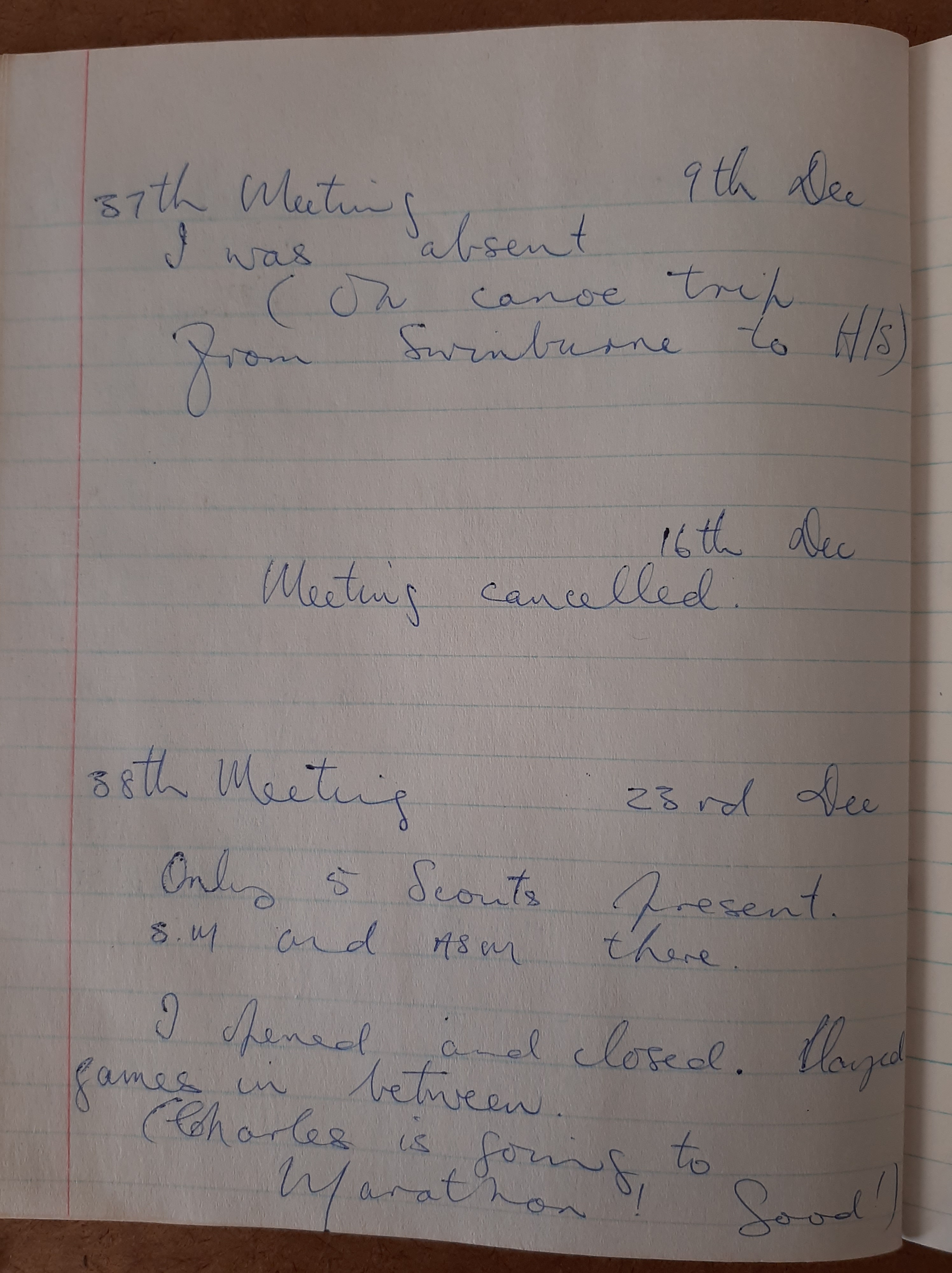
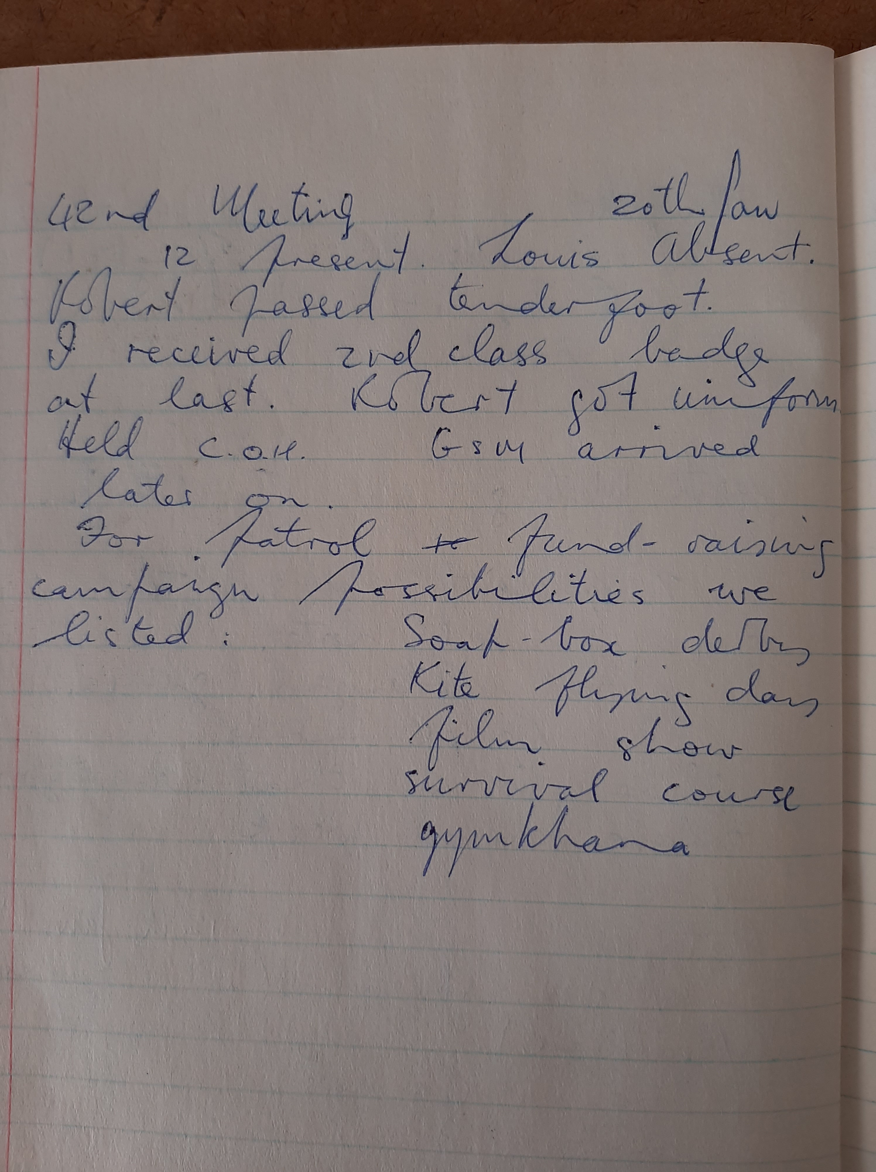
All this in his own time and on – I would guess – not a huge salary as a rooinek dominee of a tiny little Anglican parish in a vrystaat dorp! I salute people like Father Sam, Dick Clarke and Charlie Ryder! They enriched and enhanced our growing up in Harrismith, going out of their way to ensure we had adventures and fun and did good stuff. Many, many men, far richer and much more influential than these three did WAY less for the kids in their town.
~~~oo0oo~~~
Oh: So what happened?
The next morning we rose at 6:20am – Greg sure watched the clock, he even said we fell asleep at 10:45pm the night before! He took a picture of this sunrise on Saturday 29 April 1972, and I made a fire and attempted and failed to bake some bread over the coals. Then at 7:20am ‘PAUL GOT UP!’ Who the hell was Paul? I have zero recollection of ‘Paul,’ yet here he was in Greg’s contemperaneously-scribbled diary, on our walk. Which I recall so clearly! (?)
We ate coffee, dried fruit, biltong and biscuits. The wind was whistling, and it musta blown page 3 away, so on page 4 the weather was still cold but warming. Still very windy from the WNW. At point C on the map we were obviously following, ‘we were only 25 yards off of our calculations!’ We calculated and read the compass and left for point D at 10:15am.
Point E at 11:30am after detouring around a vlei and throwing my pack across a stream (!). Point F was some half-dead trees and some ruins and we rested there for ten minutes to 12:20pm.
Point G was a willow tree, a stone pillar and a little dam. We found it after a longish detour to find a place where we could cross the stream which was 4ft deep and 20ft wide. Greg sure provided detail! There we had lunch and a rest till 1:30pm. No mention of what we had for lunch but my guess would be coffee, dried fruit, biltong and biscuits. We ate in the shade while the mysterious Paul slept in the sun. Point H was an empty house and barn down a farm road. After a tricky crossing of a stream we were looking for a windmill. A glint of sun reflected off it revealed it and we headed up a rough hill, stopping halfway up for a rest and a drink. We reached the windmill, point I at 4:15pm and ate an apple.
When we weren’t sure of our position, we would seat mystery fella Paul under a tree and Greg and I would go and check and then come back, so the mystery Paul wouldn’t get too tired, I suppose?
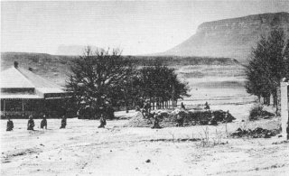
We were now headed for a Mr Blom’s farm. On the way we got our first glimpse of Platberg in the distance, so that was heartening. We reached Mr Blom’s house at 4:45pm and he invited us in for tea! We chatted till ‘about 5:30pm’ – HA! Greg was less accurate over tea! – when it started to rain.
We moved to camp, Mr Blom having kindly given us milk, apples, grapes and water! We cooked and ate supper at 9:30pm – spaghetti! But also beef stroganoff and oxtail soup. Paul went to sleep at 9pm! So, hike scribe Greg notes, ‘Pete and I gorged ourselves on the beef strog.’
‘We finally climbed in at 9:45pm. We we asleep . . ‘
It ends like that.
~~~oo0oo~~~
Greg called the adventure Operation Headache – and it occurs to me: Father Sam must have spent hours beforehand setting up the course! Taking compass readings, probably meeting Mnr Blom and getting his co-operation, probably other farmers whose land we crossed, too. What an absolute star! We loved those three days and spoke about the hike in years – decades – to follow.
As proof that We Wuz There, we got Mr Blom’s signature:

Greg’s notes in his unmistakable spidery handwriting:

. . . and I found half of page 3: It said we stopped at a spring and drank. We saw ‘several freshwater crabs, insect larvae and a frog.’
A map I drew of our first campsite:
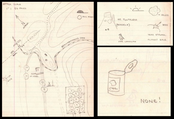
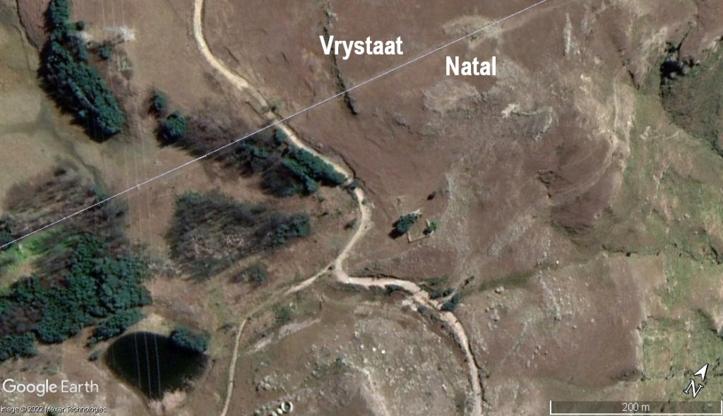
Accuracy check: What does a satellite pic of the area look like fifty years later? Hmmm . . . good thing I wrote ‘approx’ on my map where I pointed NORTH! And that wind was SW wasn’t it?
Greg Seibert and I lost touch for decades. When we reconnected we decided two things: He would visit South Africa and we’d go to a game reserve and talk shit for hours; And he’d share his pictures from 1972 with me. Well, neither happened. Greg died suddenly and DAMMIT!! Later, I met his brother Jeff and took him to Hluhluwe–Mfolosi game reserve.
~~oo0oo~~~
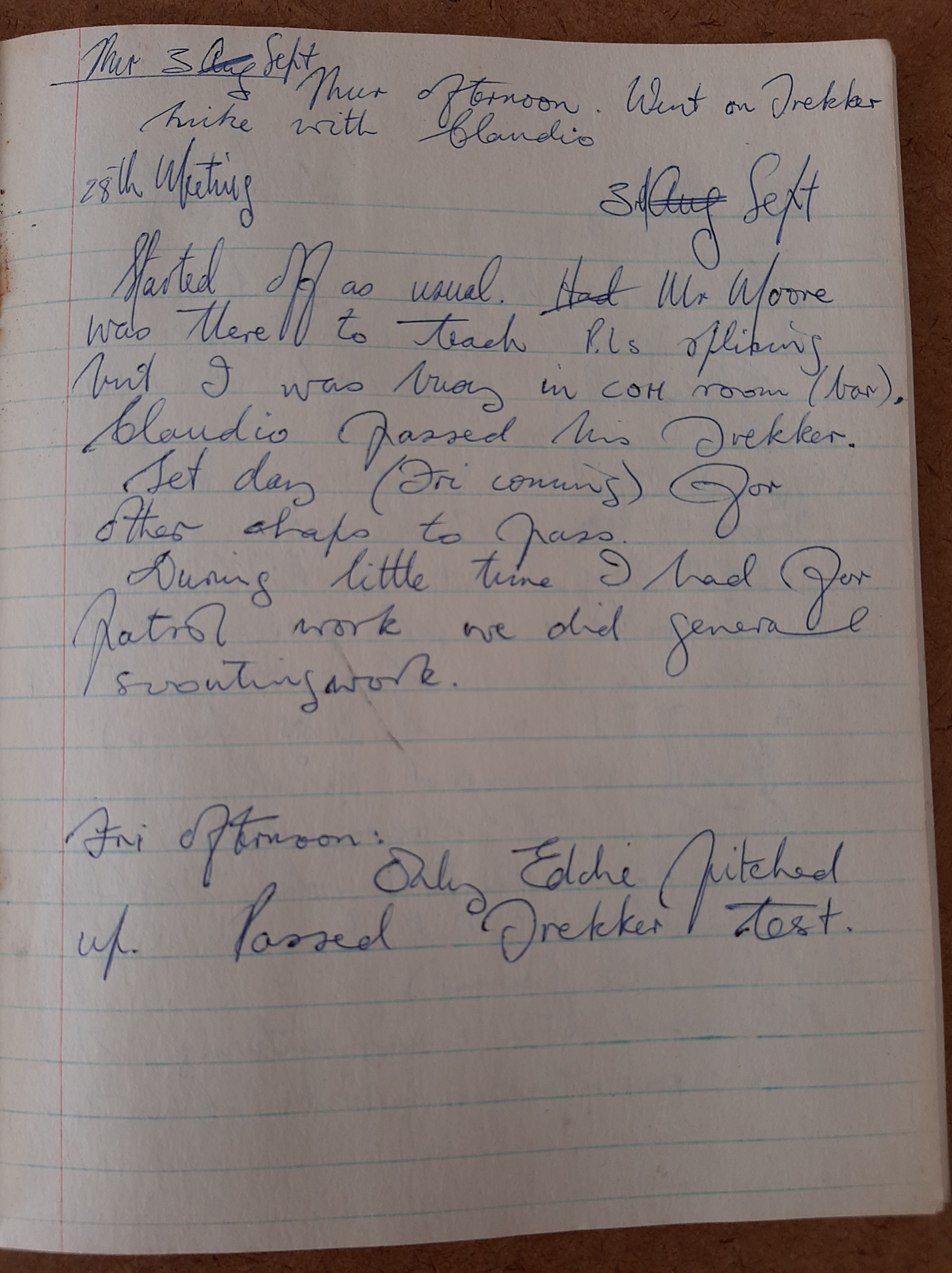
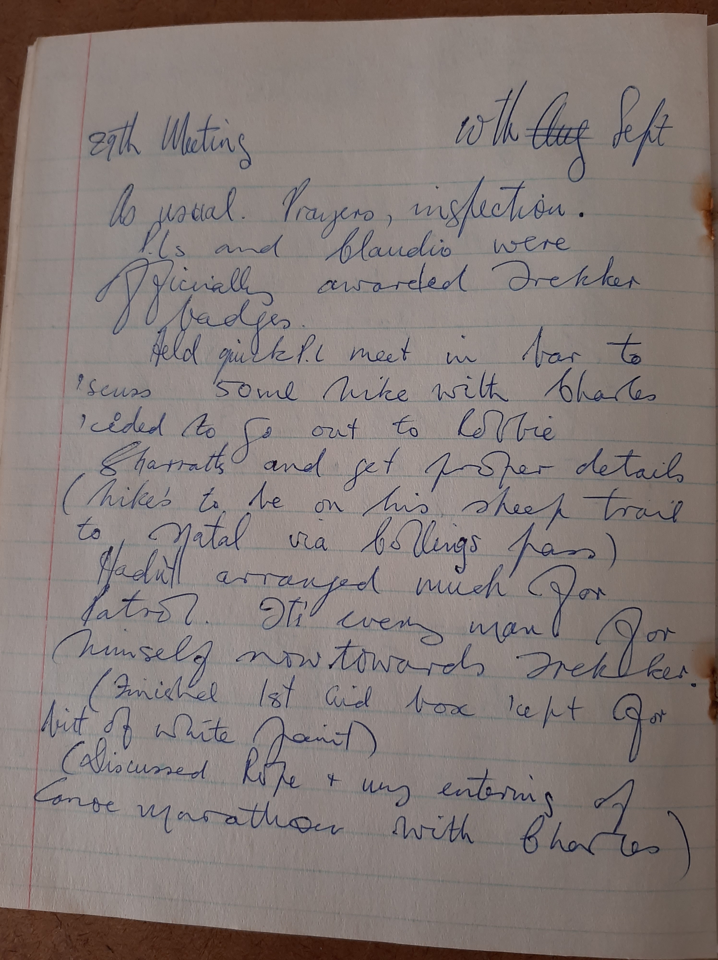
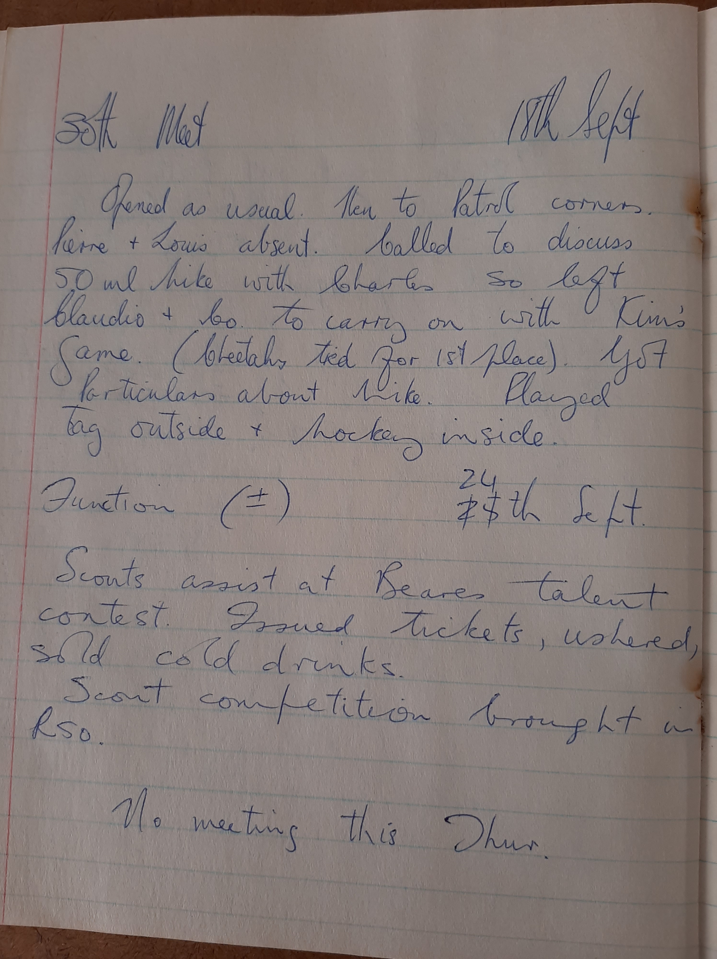
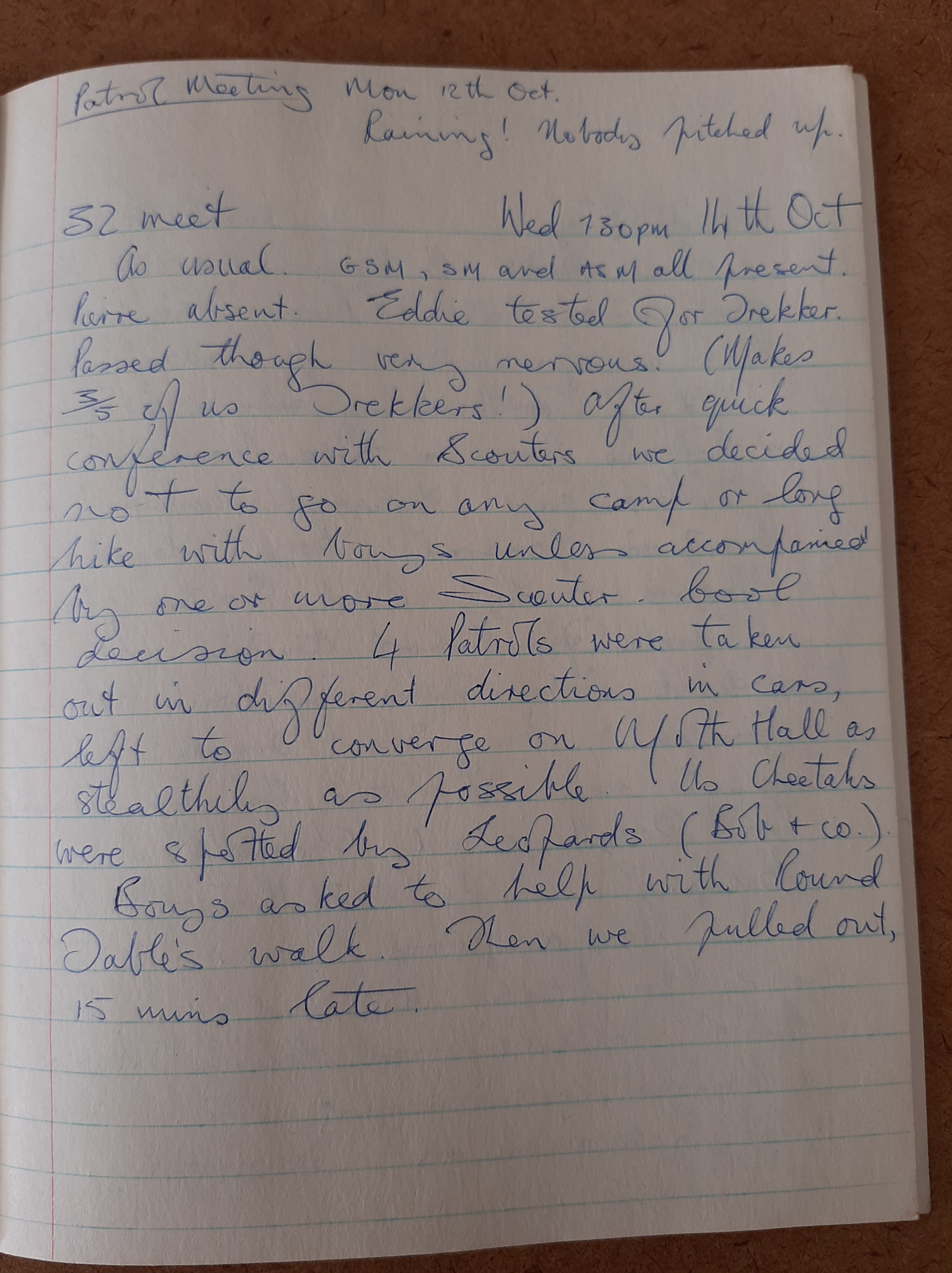
Here’s another map, another hike. Maybe my 50 miler hike near Normandien Pass.
Drawings on a hike – in the Drakensberg on the Vrystaat / Natal border again – our usual place; may be same hike, I don’t know:


~~oo0oo~~